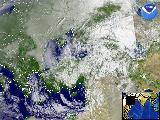
Data Elements: Snow showers moving over parts of Turkey and the Black Sea. Observation Device: DMSP F-14 2.7 km visible imagery. Visualization Date: February 26, 2003 09:37:18 Source: NOAA Environmental Visualization Program Front Page

