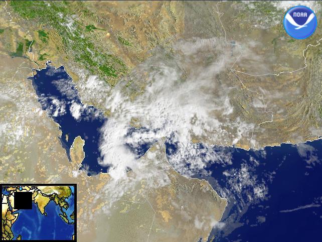
Data Elements: Convective activity over the Persian Gulf, near Dubayy. Observation Device:DMSP F-14 2.7 km visible imagery. Visualization Date:February 24, 2003 09:18:34 Source: NOAA Environmental Visualization Program Front Page

