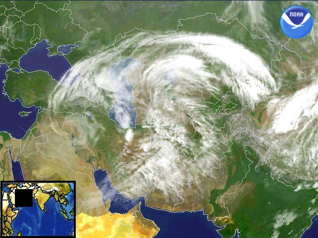
Data Elements: An area of low pressure moving over parts of the Middle East is bringing showers and storms to those areas.
Observation Device: Meteosat 5 4 km infrared imagery.
Visualization Date: March 26, 2003 09:25:48
Source: NOAA Environmental Visualization Program
 Front Page Front Page
| 